View Larger Map | Get Directions | View Bird's Eye
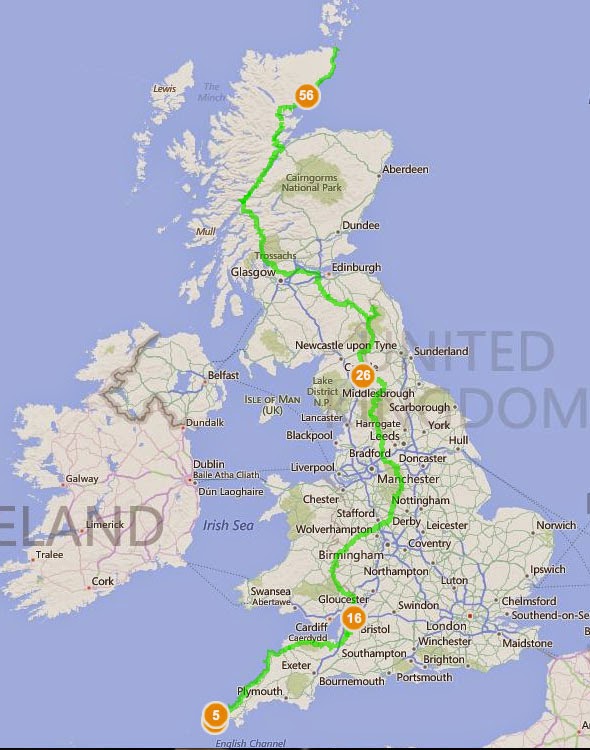
Possible route from Lands End to O'Groats on Foot. Just spent the last three days plotting it across Bings Ordnance Survey Maps- did you know they had them free across the whole of England!!!! This has definitely earned them my love.
Does anyone know an easy way to avoid trudging up the A roads at the end? I'm trying to navigate a different route but I suspect it'll be me lost in moor land swearing and daydreaming about passing cars and tarmac.
Over the next few weeks I'll be breaking down the walk into smaller sections and playing around with possible alternatives but I wanted to get a better idea of the distances and terrain first. Boy is it daunting. Any advice PLEASE email.
Route tracked a mixture of Andy Robinson's route in 'The End to End Trail' (books bloody heavy, no way I'd carry that with me and the maps are a little confusing but it is helpful) and 'When I Walk, I Bounce: Walking from Land's End to John o'Groats ' by Mark Maxon (personal account of the walk, not guide, but funny and engaging)
This route partly goes along the following National Trails:
South West Coastal Path
Offa's Dyke Path
Pennine Way
West Highland Way
Great Glenn Trail
I've partly chosen it because it covers half of Offa's Dyke instead of remaining more central and walking up the Cotswold Way. I've done the majority of the Cotswold Way already and find open moors more more appealing than a long stream of golf courses.
DISCLAIMER - other peoples routes and I've yet to walk them. All this is is a very carefully plotted trail based on their instructions.
No comments:
Post a Comment