Showing posts with label Womens Equipment. Show all posts

Saturday, 18 April 2015

Day 3 of 3 Crowden to Hadfield


Short walk today, campsite to the Didsbury Intake's disused quarry, then back down to the reservoir and along the path to Had field. It's a day with a stiff climb over the first mile and then easy walking with pretty views.

  The night was cold and I woke several times. In the end I slept in to enjoy the final warmth of the morning. Not eating breakfast I packed up and headed out determined to find a pretty view from which to eat.
View up in the quarry while having lunch
View from the reservoir back to the quarry
The climb was hard but the views were great from the top and the path along the quarry pretty. It's on this path that I stopped and cooked myself some cuscus. It's the first time I'd done this in such a deliberate manner. I should have taken my shoes off and let them breath but worried about time didn't bother. My soles had began to hurt like on the Pennine way, the third day seems to be the painful one.
  The walk along the reservoir is flat and easy although I felt quite tired at this point and was glad to reach the train station and head home for a bath.
  Next hike is the big one!

Wednesday, 11 March 2015

Preparing for a Longer Walk


Walk?  End to End - Lands End to John o'Groats 

When?                                              May- August

Projected days?                                 80 odd days 

Weight of Pack (estimate)?   17 kilos/ 35 pounds

Fitness

  The walk will, obviously, only be enjoyed if my body is up for the challenge. At present it is not. But I still have two months and have just secured the kind sponsorship of Wilmslow Leisure Center which will allow me access to their gym and swimming pool. I live in beautiful Cheshire, near the Pennines and beauties like Lyme Park and Styal woods. Plenty of places to explore and get my feet ready for 10 hours a day walking. ON the Pennine Way the first five days were hell on my souls, I don't want to do that again.
  What do I need to do?

  1. One long walk a week, with two or so lighter ones
  2. Gym 3 times a weeks with hard work outs focusing on key muscle groups (pretend here that I have a clue what that means.)
  3. Eat healthier and drink a lot of water so the fitness isn't wrecked by gluttony 
  Richard at Wilmslow Leisure Center is sorting out my pass and arranging some free fitness instruction which will make a big difference. If I take proper advantage of their help there is still enough time to get my body in shape.
   I've gone on two walks in the last few weeks with my backpack full and ready to camp. This allows me to strengthen my back and legs with exactly the weight I'll be carrying along the way. The only problem I've struggled with is the cold. On the last walk I layered till I could barely lower my arms but to no avail. I shivered and got down off the moors are quickly as humanly possible. Bring on the Spring!!


Equipment- Sponsorship

 As I've walked in the past I have all the bare necessities sorted but I have been working hard to get sponsorship and upgrade as much as I can before the start. I've never walked such a length and any advantage I can get I will do with pleasure. Its my first attempt at getting sponsorship and, so long as you willing to spend a number of hours sending emails, has been very successful. So far the companies who have agreed to help me are:

View Ranger  

Ordnance Survey (GB) http://www.viewranger.com/en-gb

  View Ranger have provided me with the maps for the entire route saving me a hell of a lot of money and, even more importantly, weight. It can all be read and followed on my phone, and recorded as I walk along. I can also add photos along the way so those sponsoring me can follow my progress. It also, if you map readings on the weaker side, can use GPS to tell you exactly where you are. You can plan your route and it will tell you both the miles and elevation. This is brilliant, and the only weight it will cost me is a external battery to make sure my phone doesn't die on me half way through a day.

Berghaus

  Berghaus were kind enough to provide me with a Women's Scafell Down Jacket. I'd hoped to provide them with some stunning photos but after this shot it rained the rest of the walk and the lovely jacket was covered my another Berghaus coat to protect me from the rain. Hopefully later this week I'll be able to take a few more.  I will review it in more detail after my next walk. Here are its specifications:
  • HydroDown technology: Innovative water repellent treatment absorbs 75% less water than regular Down; dries 50% faster than regular Down; will still keep you warm when wet
  • Two concealed hand warmer pockets zipped
  • Stretch bound cuffs

Deuter    

 Deuter has promised me a Deuter Aircontact 60+ 10 SL and I can't wait to try it out. The photo are from Australia and my smaller backpack. I actually sent these to the sponsorship department in a bid to win their support. Considering I'm currently using a 60 Liter Black backpack bought from a second hand shop for a tenner my excitement is understandable. Here are the specifications of my future baby:
  • New front, quick access opening
  • energy saving comfort due to the anatomically shaped and pivoting Vari Flex hip fins, which follow your every move precise load control due to compression straps on hip fins
  • Pull-Forward hip belt buckle, easy to fasten even when heavily laden
  • Stable multi-chamber aluminium X-frame transfers load to the hip belt
  • ergonomically shaped head moulding and positionable lid pocket with compression strap allow freedom of head movement
  • Three side compression straps in 60+10, 65+10 & 75+10
  • Hydration system compatible side bellows pockets
  • Hip belt zipped pocket
  • Lid pocket
  • Two daisy chains
  • Top lid attachment rings
  • Ice axe and hiking pole loop
  • Lower side pockets for tent poles
  • Double-layered base
  • Integrated detachable rain cover
  • Zipped map pockets on the side
   Will report back once I have it and have tested it. 

What I'm still fishing for:

  I am still emailing for a few items of equipment, one been a good lightweight warm sleeping back, possibly synthetic down. Second being a pair of hiking shoes and sandals. Wouldn't say no to a replacement tent either. But if these items are the only things I get then I'll consider myself very fortunate.


Organization- Accommodation Sponsorship

  I've spent several weeks planning my route and contacting campsites. Heres another area where you can apply for sponsorship. If the walk is for a charity, and is impressive enough, then a lot of kind souls are willing to allow you to camp for free. Considering that some of the campsites along the south west coastal path cost 10 or 12 pounds a person this is quite a gift. So far the kind souls providing me a free pitch are: 

  1. Trevedra Farm Caravan and Camping Site
  2. Trevalgan Touring Park  
  3. Trewiston Farm Caravan Park
  4. Potseath Camping 
  5. Loveland Farm
  6. Stoke Barton Farm
  7. Cerenety Eco Campsite
  8. Westacott Farm 
  9. The Fairways Holiday Park  
  10. Medip Camp
  11. Cheddar Campsite
  12. Beeches Farm Campsite
  13. Wye  Tipi Camping  
  14. Walton Court  
  15. Brook Farm Cottage and Camp Site  
  16. Newhaven Nr Buxton  
  17. Low Way Farm  
  18. Grandie Caravan Park
  19. Border Forest Caravan Park
  20. Forest view inn walkers 
  21. Beinglas Farm Campsite   
  22. Bunchrew Caravan Park 
   I WILL REVIEW AS I PASS THROUGH BUT FOR NOW LET ME SAY THANK YOU!  
 

Choosing and Setting up a Charity


  Choosing a charity took me quite some time. I wanted to support something which helped women in developing countries receive an education. After a bit of research I found Wilmslow Wells for Africa. They raise funds to build wells in some of the most desolate parts of Africa. In these villages women are ofter forced to walk over a mile to reach a water supply. Water borne diseases kill many and cause illness, but without any other choice there is little these people can do. A well with clean water can change so much. Now the women and children don't have to spend two hours retrieving water they can work on small businesses (such as making cheeses from their goats), their children can be sent to school and illness decreases. It doesn't work to educate women directly but it provides an environment where the chances of them leading a better life are dramatically increased. Hopefully this walk can be used to spread the word about their good work and raise enough funds to make a difference to their lives. 95 % off money donated to this charity is spend in Africa. More information can be found on their website: http://www.wilmslowwells.org/

TO DONATE

 https://www.givey.com/girlgoeshiking

Mental Preperations


  The idea of walking three months straight alone is quite daunting, its a whole term and university. I've read several guides on the subject but they are working to give you information and not an idea of what it'll be like. Your also dealing with a very subjective topic. I read two books so far, one about a hiker and the other about cycling it:

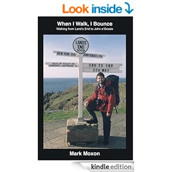
When I Walk, I Bounce: Walking from Land's End to John o'Groats


"Convinced that walking from Land's End to John o'Groats will be a pleasant way to spend the summer, Mark Moxon soon discovers that there's a lot more to crossing Britain than simply putting one foot in front of the other. In this entertaining and frequently hilarious book, Mark takes us on a journey not only of 1111 miles, but of the highs and lows of long-distance walking."

  A well written and humorous account of the walk, easy to read although I confess I did skip about a bit to which ever section I was researching. Since I am not walking this particular route some bits I ignored. I also lover the moors and hate any type of road walking, he is the opposite way inclined and therefore a lot of the moaning in sections I ignored. He hated the Pennine Way while I love it.
  Worth a read.


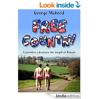
Free Country: A Penniless Adventure the Length of Britain

 
" The plan is simple. George and Ben have three weeks to cycle 1000 miles from the bottom of England to the top of Scotland. There is just one small problem… they have no bikes, no clothes, no food and no money. Setting off in just a pair of Union Jack boxer shorts, they attempt to rely on the generosity of the British public for everything from food to accommodation, clothes to shoes, and bikes to beer.

During the most hilarious adventure, George and Ben encounter some of Great Britain's most eccentric and extraordinary characters and find themselves in the most ridiculous situations. Free Country is guaranteed to make you laugh (you may even shed a tear). It will restore your faith in humanity and leave you with a big smile on your face and a warm feeling inside"


   A great read but you wouldn't catch me dead trying it. I feel unprepared as it is and I have every single piece of gear needed. I am to receive free accommodation but obtained through emails not face to face appeals. Still is gives you courage that is they can do it then surely you, with everything you might need, can. Even if your walking it like me its worth a read.

Thursday, 22 January 2015

Gear Review - Scarpa Ranger II ActTX Womens Walking Boots


 Bought - May 2013 
Distance - 300 Miles
 Price - 160.00
  Shoe Size - 7 

PROS

  As advertised they are waterproof and insulating, protecting you from the path with impressively thick and hard soles. These boots are hard and built to last. They look like they've been taken a strolls over the fields not 300 miles over moor land, through marshlands and gravel lanes and roads. Scarpa boots are designed to survive pretty much everything. The only problem is my feet might not survive them over the course of another walk.


 CONS

    I bought these in preparation for the Pennine Way. They are heavy boots, the ankles cushioned and very well padded fixing your foot in place. They advertise that "Auto-fit foam inserts in heel area provide perfect foot hold and increased comfort" and for the first twenty miles this is fine, and while they aren't as cushy as they appear in the shop they seem fit for the job. By the fortieth mile however things go down hill. First its important to note that I have wide feet and not dainty skinny ankles. I suspect shoes are like a kiss and its not about how skilled one person is but how they fit together. These boots and I were never meant to be. For the entire Pennine Way, 250 Miles, they game me hell blistered my left heel and compressed it so that it could hardly carry any weight. I only carried on my heavily plastering it and wearing a supportive bandage. I assumed I'd just not broken them in enough, that my feet had just not hardened to the trail, but since then I've come to realize that it wasn't me it what the boots. On the Cotswold Way, a 100 mile walk, they'd given me five blisters on one foot and three on the other by the second day, and soon after my heel began to hurt for the first time since the Pennines. I've concluded that the constraints around the heel compressed my ankle too much, as my feet were simply too wide. Even if they did fit well its also worth noting just how heavy these boots are, and once they're wet they drag.

Upper Material: Leather
Waterproof: Yes
Waterproof Technology: GORE-TEX®
Height: Boot Cut
Insole: Viscoflex Activ fit insole with memory foam
Midsole: Hi-Flex
Sole Type: Vibram®
Stiffness: Soft, for low level walks on defined trials
Lacing Type: Standard Lace Up
Boot Grade: B0 - not suitable for crampons
Ideal Crampon Rating: Not Crampon Compatible

 
CONCLUSION

   I wouldn't buy another Scarpa boot. In fact I took quite a lot of pleasure in selling them on ebay and using the money to buy myself a forty pound pair of Trespass walking boots. These Trespass boots are light, waterproof and an instant match. I took them on a thirty mile hike and didn't get a single blister. I hated how heavy Scarpa boots were, hated putting them on in the morning and there are simply not enough plasters in the world to make them comfortable.

Wednesday, 21 January 2015

Gear Review - Black Diamond Trail Women's Trekking Poles - Pair


Last day on the Pennine Way, England, during a 28 Mile stint 2013
Bought: November 2012
Miles Covered: 500+ Miles
My height: 5 foot 5  
My Weight : 15 Stone + backpack


Black Diamond Trail Women's Trekking Poles - Pair
  • 3-section poles provide patented FlickLock adjustability and solid, slip-free security
  • Simply flick the lock open, set the length and flick the lock closed—a quick, tight, and easily accomplished task, even with gloved hands
  • Soft, dual-density foam grips and extensions have padded wrist straps for security
  • Poles extend from 23 to 49 in.
  • The Black Diamond Trail trekking poles include low profile baskets for general use and powder baskets for use in the snow
 I found the straps annoying so chopped them off in a fit of ultra-lite hiking verve. Apart from that there's nothing negative to say about them, they support my weight reliably and have never let me down. I'm quite a heavy girl, especially while carrying a backpack and not once did the extensions collapse on themselves and I've barely walked a mile without their help. On a number of occasions I've nearly fallen and placed all my weight on one of them, they bent slightly but held. The handles allow you to grip securely and in varied grips while the textured foam handles prevent you from slipping from sweat.The heights are easily adjustable and show no sign of failing, and make it easy to pack them away once they've been used.There is no shock absorption but I've never felt jarred by them, perhaps this would not be the case if I were walking a long distance on tarmac or concrete.
   I bought these poles because a shop keeper had told me they'd be needed in the Blue Mountains. Before I used them I suspected they were either for the wimpy of elderly but not strong hikers such as I'd be...eventually. Within half an hour of been dropped off on Morton Island I'd changed my mind and relied on them on every hike since in England and Australia. They are essential when crossing difficult or slippy land, they are also very useful in relieving you of some of the weight of the rucksack. They can pull you up a hill and assist when your trying to descend one safely. More that that, when your in Australia or anywhere else that's inhabited with poisonous snakes, they provide a barrier and protected obstruction which might make all the difference on either side of your legs.As for picking up a stick from the bush instead...why would you when both poles together weight only 1oz and can be packed away when not needed?

Descending down into the valley in the Blue Mountains 2013
SpecificationDescription
Best useHiking
Shaft materialAluminum
Grip materialFoam
AdjustableYes
Maximum length (in.)49 inches
Minimum length (in.)23 inches
Maximum length (cm)125 centimeters
Minimum length (cm)59 centimeters
Locking mechanismExternal lever lock
Shock absorbingNo
Camera mountNo
Weight per pair1 lb. 1 oz.
GenderWomen's


Crossing a shallow creeks in the Australian bush 2012


Friday, 22 August 2014

Gear Review - The Jetboil Zip Cooking System


  • Drink-through lid with pour spout & strainer
  • Bottom cover doubles as a measuring cup and bowl
  • Compatible with all Jetboil accessories
  • Weight: 12oz (345g)
  • Volume: 27oz (0.8 litre)
  • Boil Time for 16oz (0.5 litre) = 2 minutes, 30 seconds (avg over life of Jetpower canister)
  • Water Boiled: 12 Litres per 100g Jetpower canister
  • Dimensions: 4.1” x 6.5” (104mm x 165mm)

Bought : October 2013 
Cost : £71.95
Meals cooked : 100+   
 PROS

 I've just finished reading 'Wild, From Lost to Found on the Pacific Crest Trail' by Cheryl Strayed and while  I appreciate that it was written about equipment in 1995, descriptions of her stove make me appreciate just how clever this device is. I've so far used it in the monsoon season of Australia, in heavy rain, open moor land, sandy and windy beaches as well as the occasional backyard gardens. It has never faltered, possibly because in its design and manufacture its wonderful simple with very few parts that might go wrong. The materials are light and durable, and easily packed away. The insulation Cargo Cozy on the main cup means that the water heats quickly, and stays warm for a while after which means you use very little fuel. Also allows you to handle it without scorching yourself. On my week long hikes where I cooked at least twice a day I'd end with plenty of fuel left in my 100G cans.  I generally ate straight from the main cup, using the measuring cup to drink out of. When I pack things away they all fit together and I slip the matches or lighter between the heating coils at the bottom, trapping them in with the measuring cup. It means my entire cooking system can fit into the side pocket of your bag weighing only 12 oz, I don't understand why people would bring much else if only cooking for yourself.
  While your restricted to single pan meals there is some leave-way since it brings the water to boil so quickly. I was able to heat water for instant mash which I made in the measuring cup before heating the sauce and pouring it on top. Since the whole operation was completed in ten minutes nothing was too cool by the time I got to eat it.

 CONS

I stopped bringing the locking pot support very quickly as it made packing things away hard and served absalutely no use unless you're bringing another pot, which in turn makes the whole system pointless. That said is allows you to adapt the jet boil to accomodate more if you go on a trip with friends. It is simple enough to leave behind and while it hasn't served me any use at all its cetrainly not ruined the devide.
  The ground stabaliser is also a little tricky and unreliably, which is important when you're cooking in the middle of the dry season in Australia and bush fired are a real danger. Again I must temper my criticism since the twice the stove fell it was at least in equal measure my own stupidity and clumsiness. 
  I remember the first time I used it I found the temperature knob very sensitive and hard to use. Since the cup it insulated its hard to have the hob low enough that the contents is allowed to stew. I found I needed to turn it off once in a while to prevent it overflowing, and then you need unscrew the pan to relight it. When it did occasionally overflow its not simply a pan covered in muck but also the insulating material, and if you have a limited water supply (as in parts of Australia) you want stuff to be as easily washable as possible. The heating system, on the subject of cleaning, is also very tricky. Moreover the lid is black and while it may increase cooking speed makes it impossible to monitor any approaching overflows. I see on their website that they have made the lids see through now which would mediate this problem considerably.

Conclusion
Cooking lunch in the Australian Bush
  I've ended up listing quite a lot of faults but they are all with the accessories, and on the whole the Jet Boil is well worth the money. Its durable and reliable. I don't cook elaborate meals on a trail, in fact I limit myself to ten minutes cooking time, often simply mixing cuscus and stock or soup powder and instant mash. What I need is something to heat water quickly, use only a little fuel and provide me with hot chocolate after. For these uses Jet Boil is wonderful and after using it the idea of bringing pans and plates seems ridiculous. I guess the best test of a product is would you be willing to spend the same again on the product after yours breaks. I most definitely would. 


Monday, 12 August 2013

P.W. Day8- Tan Hill to Middleton-in-Teesdale 16.5miles

  The rain was hard when I woke, so hard that I didn't even try to take any photos but packed the camera away in my bag. Mainly it was drizzle but continuous and the path was non-existent. The moor holds markers every few hundred meters but no set path or slabs. Its a matter of constant navigation using compass baring and hoping another white pillar will turn up to tell you that you'd not made a mistake. To make things worse the rain had saturated the ground, the water never less than an inch deep and at times a foot or two. I fell a few times and at one point twisted my right ankle badly, my left heel much worse making every footstep horrible.
  The moor seemed to last forever and a day, and it was with incredible relief that I finally reached a road. Here I stopped and tried to do something for my ankles, the twisted one not wanting to take much weight while the other one was simply in a lot of pain. It made me shred tears of frustration, especially when I'd had such an easy day the day before. I bandaged up the heel, covering the blister and all the rest of the back of the heel and it made a big difference. Still I limped along and hated every moment.
  The rest bite of walking on the roads is small and I was quickly back in the sodden moors struggling to keep my boots from been sucked off by the mud and my ankles twisting from under me continually. This section needs to be slabbed before I do it again, stuff the 'leave the moors as they are' people, bring on the slabs. It must be much worse for the environment to have people trudging over the bushes looking for less muddy routes.
  Here you have a choice, easier terrain but longer or more moor land, no path but several miles less. I decided that I was in pain either way, the shoes were full of mud so I might as well carry on with the moors. None were quite as bad as Tan Hill but it was hard and slow going, the entire way with little to help navigate. You work mainly from a sense of the right route and the compass, and since the moorland in England is mainly a thin strip its hard to go that much wrong and its easily correctable as soon as you reach the next road.
  There was some difficulty when I reached Baldersdale, I came out several hundred meters further up  the road, at some point having left the trail, but after climbing over a fence and getting a little stuck
the mistake was quickly corrected and I trudged onward. At this point I was walking extremely slowly and with no energy, stopping far too much and struggling with my ankles. I could have stopped at Clove Lodge campsite but, walking past, it seemed a deserted farm yard and it was still early in the day. I would not give up the momentum I'd buit in the last few days.
  Climbing past Hannah's Medow I stopped to read the sign describing the place. I held little interest but any excuse to stop was welcomed. What followed was a lot of farmers fields full of friendly and not so friendly cows. The younger ones were the only ones to show aggression while the bull was too busy following a poor lady cow in circles around the field. This section is really a matter of styles, farm fields, a road, a farm drive, sheds, another field, and another road. Not the most inspired section and I was in no mood.
  Finally Middle-in-Teesdale came into view down the slope from me and limping I gratefully quickened my pace. No one was at the Dalesview Campsite reception but following the signs I easily found the empty camping area and set up. Once showered I lay and rested, cream on my aching limbs and already decided that I was giving myself tomorrow off. The next section was 21 miles and I wasn't going to attempt it till my ankle was better and I had a bandage for the heel.
  I spent the night in the campsite pub, ate their plain but cheap meal and drunk tea until my electrics were sufficiently recharged for me to watch North and South on my ipod.
 

Friday, 9 August 2013

Pennine Way Day6- Gargrave to Horton-in-Riddlesdale 21miles

  This is the day you begin the walk you imagined, and for me probably the best on the entire Pennine Way. Hard, disbelievingly long but the landscape you see while you're up there takes your breath away in every sense. Whats even better is that after Malham there are no more villages or roads its just moor land and paths. I began fed up with the entire walk and second guessing myself and ended walking into camp like the living dead but exhilarated and excited about whats to come. This is the real start of the walk.  
  The day started like the others, the path meandering through hamlets and across country paths and rivers. This section is simple enough, holds a few too many gates and styles for someone carrying a twenty pound bag, but I reached Malham my midday.
  Malham is gorgeous, full of life and bustle and completely covered in tourists, which was understandable since the weather was wonderful. I stopped at Old Barn Cafe for beans on toast and a hot chocolate.

  From there its a 15 mile straight walk up to Malham Cove and finally a sense of majesty and wilderness.  This is the site of an ancient waterfall and the start of limestone country, springy turf and very little bogs.
From the top of Malham Cove

Malham Cove
  The path covered with tourist follows the river to Malham cove and then climbs up some sturdy steps to the top of the falls. Its pretty steady and with a few pauses for breath a much easier alternative to rough land. I did feel a bit like a pack-horse compared to other people around me with day packs but as soon as you reach the top you leave the crowds.
  Its a little confusing here but if you turn right as instructed and work your way to the back you eventually stumble upon the style and enclosed path. The terrain before the style is intense, the lime stone worn away to form spike like areas with foot deep gabs between. One slight slip and a very very painful wound.
  The climb continues but steadily and the audiobook of Lord of the Rings: The Two Towers is my constant companion. Once the Pennine Way turns away from the main walkers routes from Malham it gets quieter again and opens up to an even more grandiose landscape.
   From here you walk down towards Malham Tarn- a large lake in front a Edwardian style house. A few people are dotted around the place but fewer and fewer as you follow the dirt track around the lake to the structure manor house. With the terrain easy and flat I covered several miles an hour and felt some of my old energy coming back. My heel had finally been overcome by medication and I was on my way. It was time to leave Lord of the Rings for a while for the quicker beats of the Lion King, there is no need to attempt coolness when hiking.
  Part of the lighthearted enjoyment of this section was the fact that there was little point in worrying how much I'd covered. I was going to be walking all day no matter what so I wasn't paying attentions to the miles.

Malham Tarn
    The dirt track goes down along the lake for a little longer before breaking away and following a stone wall up to the farm. As with Stoodley Pike the lake gives a satisfying sense of distance as you move away and it shrinks into the landscape.
  The fields, like most I'd gone through the last week, were full of sheep and the path was indistinct. Keeping to the wall its a stunning view nonetheless. Then its a quick jaunt up to the farmyard and then a steep climb back into the abandoned and solitary moor land of Fountains Fell. Any tiredness is easily recuperated by glancing behind at Malham Tarn shrinking behind me, and the open wilderness in front as far as the eye can see.
Fountain Fell Moors
  Fountain Fell is a wonderful path and in less than an hour I was already descending a steep track to the valley road. The pains in legs, heel and back were all intensified by the concrete under-foot. I was now ready to reach camp. I figured I must have covered the majority of the ascent and there were only two or so pages of maps left in the guidebook. I hadn't realised that within those two small pages there was another ascent to 696 meters as the Pennine Way pops up to Pen-y-ghent- one of Yorkshire's three peaks. Parts of this climb is literally a climb, which with the rising winds threatened to push me off. I was a little scared but there was little other choice and once it was completed it would be all down hill.
The path doesn't twist around, but goes right up over those rocks


From neat the top of Pen-y-ghent
   
Top of Pen-y-ghent

Pen-y-ghent as I descended into Horton-in-Riddlesdale- the Pennine way pretty much follows the profile in view.
Path down to Horton-in-Riddlesdale
     The decent was painful but with me giggling and talking my way to camp like a crazy woman not without its moments. It took at least an hour to get into the town making today's walking time well over thirteen hours but having the destination in view makes such a difference. My feet felt like sponges on sharp stones, every step baring the entire weight of the backpack. It didn't matter though, I'd done it and I was finally engaged in the walk and excited about what was to come. I kept on glancing back at what I'd just climbed over as it began to look above me and couldn't stop grinning.
   It was nearly dusk already and I was a little worried about finding somewhere to camp. Once in a while I glanced around to see if there was a handy corner to pitch my tent but I was nearly out of water and in need of a good meal and a toilet. I checked the map and concluded that the best course would be to go to the first campsite I spotted and hope there would be space. It was a Sunday though and the hordes at Malham might have been an ill omen. With an hour left of daylight I reached Holme Farm, a massive makeshift campsite run my a loudly spoken and friendly Scottish man. Tents filled two large fields and a number of loud parties were taking place. I headed away from the large crowd and found a slightly quieter patch behind the edge facing the smaller of the two fields and a family tent. For a little while I simply lay on my rucksack as I felt my feet decompress from the shoes. The mother of the family drifted over and introduced me to her wonderfull husky. I was glad of the introduction so I'd know where to direct my screams should the need occur. This was the fullest and most inebriated of the campsites I'd come to and I felt a little more weary than usual.
  Stiffly I raised my tent and not bothering to shower sorted out my stuff and eating my powdered soup/couscous concoction fell straight to sleep with my earphones in place to block out the drunken uproar around me.

Thursday, 8 August 2013

Pennine Way Day5- Pondon to Gargrave 14.5 miles

  This day is an extremely dull one and there is very little to note about it. I only took around a dozen photographs and filed less than three. You start off by following the reservoir round and take the road up back out the valley. The road is broad and clear and the only annoyance is the passive aggression shown by the farmers here and there.

   At one point you pass a strange series of cabins, very stoutly built but in the middle of nowhere. The guide is equally unsure suggesting the possibility that they were hunting cabins. Its another awkward passage through a village and back up through an endless maze of farm fields.
  I paused at the Hare and Hound Inn for lunch, soup and onion rings before climbing up for the last 8 miles, slightly annoyed that I'd only managed to cover six and a half. The food was great though and rejuvenated me. I also talked briefly to an elderly gentleman on a walking stick who's walked it fifty or so years ago. He still had pride in his voice has he described it and reiterated what a wonderful experience it was.
  Thornton-in-Craven was a little confusing and once again my pace went down to a mile an hour as I tried to find my way around. After my previous disasters at navigation I doubled checked everything, using the map to cross reference the guide book. On the way up another road I stopped at a house with a hose outside and asked to refill my water bladder. It wasn't that empty but since it was a warm day it made sense to be cautious.

  Not that long later, and a easy stroll up Leeds-Liverpool Canal through East Morton, I arrived in Gargrave. I'd originally planned to stay in East Morton but Gargrave was only a little further and the extra stretch gave me the option the next day to walk all the way to Horton-in-Riddlesdale instead of been stuck in Melham tomorrow night only 8.5 miles on. The stretch between Melham and Horton-in-Riddlesdale is 15 miles of hard and steep walking, if I added on the distance between Gargrave and Melham it equaled a 21 mile day. I'd been struggling with 15 and I was sick of it so I figured I'd get a hard day under may belt and gain confidence that I could do this walk.
Leeds-Liverpool Canal
  Gragrave seemed a very pretty town but I'd walked another eleven hour day and both my feet and my left heel were on fire. I stopped in a co-opperative store and bought an obscene amount of food. I decided on brae, cuotomali, and baguette for mains with peaches for desert. I also bought snack food for the next day or two. The campsite was flat and with washing facilities including a clothes ladle with I liked. I showered and ate my meal outside the laundry rooms as my electricals charged. I was a little worried about them been stolen on such a busy caravan site.
  I lovely couple on holiday were also at the site in their enormous tent and they kept offering me things like a chair or coffee. I thanked them but declined. A larger tent stood behind me housing a loud family with kids but with my Ipod on I fell easily asleep just before the rain came.

Wednesday, 7 August 2013

Penning Way Day4- Mankinhole to Stanbury 15 Miles


 The days official millage doesn't include the climb back up to Stoodley Pike which had been bothering me the night before. I woke early and collected my recharged phone from the bathrooms, packed my stuff and headed for the shortest but steepest route to the top. I was tempted to walk along the valley floor till it rejoined the Way but I found I couldn't miss such a key point of the Way and meet peoples eye when I claim to have completed it.
  It was a stiff and hard climb but once I committed to it it wasn't so bad and the view from the top was lovely. I also hadn't realised that the pike was hollow and easy to climb up. I dumped my bag on the ground and, slightly light headed from relief, climbed to the top. The actual Pennine Way, if you choose not to camp in Mankinholes, is pretty level stretching across the moors alongside the valley. You soon cross the Pennine Bridleway, one of a few times the two walks cross paths, and slopes down to Lower Rough Head Farm. The navigation is easy and the path is clearly boarded by a stone wall to the left. You finally wind down a more zigzag path to Mytholm, crossing a dingy canal and railway. The towns here look a little desolate and abandoned.

Descending from the Pike

Satisfying view of how far I'd traveled

From around Cinder Lane
  Here starts an incredibly frustrating and unsatisfying hour winding your way back up the other side of the valley through pockets of houses, stairs going alongside gardens and behind buildings. There's a interesting abandoned graveyard marked with a 'Wainwright Sign' which gave me a bit of a navigational problem but it was soon solved and I gained added confidence in my skills.
Abandoned Graveyard
  Winding up and away from the graveyard the houses finally grow a tad scarcer, Stoodley Pike still stood in the distance giving you a satisfying sense of the distance you've covered- if at the speed of a arthritic turtle. The progress is horribly slow. I think next time I do this walk I'll do as suggested and carry on past Mankinholes and onto Mytholm to camp in Badger Fields Farm- its closer to the path and would get this ugly section over and done with. You pass through farm gardens, wined between yards and over styles until you're completely turned around. Some paths are well kept but others are boxed in by walls and allowed to go wild and overgrown.
The beginning of a week long problem
  There is a lovely river between the many roads where a family was having a picnic and would have been a wonderful place for local families. Up another valley side and a very posh drive I reached Cinder Lane and diverted to Aladdin's Cave for supplies. Bought an orange juice, and orange (I sometimes eat healthy when walking) and my monthly female requirements before plastering the newly formed blisters on my heel. I should have stopped before it had become so big.


 Finally you break onto open moor land, five or so hours after I started. In that time I'd only covered five miles, maybe six with the climb back up from Mankinholes. That left me another ten miles to go which as my current pace was never going to happen. But as soon as the roads and houses were left behing and the landscape sweeps up around you my pace doubled and I began to enjoy the day. I was also very excited about passing the supposed location Emily Bronte had based Wuthering Heights. We'd studied Emily Bronte at high school and no other book had hit me quite so hard. I've read it nearly five times and have always wanted to see where it might have been set.

   There's a wonderful section where you drop into a ravine and crisscross the stream in these wooden bridges. It a very quaint set up and exactly as I'd have imagined Monet's garden. I'd hoped to pause around here and skip the half a kilometer to Packhorse Inn for lunch but time had gotten away from me. I was taking twice the suggested time of the guidebook and by the time I passed it had shut till dinner time.
Path down to Wuthering Heights


The ruin in the distance
    Following another dull series of reservoirs you finally reach Within Heights and my sought after ruin. The land is also very tame and easy here and the warm weather overcasts everything with a golden hue. Tourism is big along here, as is evident by the Japanese sign post indicating the direction to Haworth.
 From here your nearly there, a quick meander down a pebbled drive to yet another reservoir. You get a real impression of how much work goes into our water supply on this walk. Through Stanbury Moor and along the rim of the reservoir to Ponden Guest house took less than an hour. I'd been walking for nearly twelve hours and felt inadequate when I read in the guide that it should have been a mere eight or nine.
Ponden Reservoir
  Ponder Guest house campsite is not a campsite. Its another case of a B&B having a spare field, although in this case its a five minute walk and a stiff climb from the only toilet.
Ponden Guest House Campsite

   While very picturesque the river had it's friendly hoard of midges as well as one or two too many campers. One lady in particular was extremely annoying, loud music and a lived-in-look to her tent as if she'd been there for several weeks. Later two more tents were set up by a friendly looking bunch of teenagers. I'm afraid I showered, cooked and slept without saying a word to any.