Showing posts with label Planning. Show all posts

Thursday, 18 June 2015

Day 45- Garrigill to Haltwhistle 16 Miles


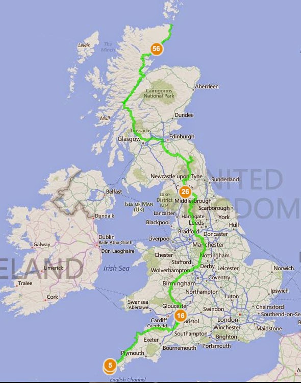
   Today's walk was a pleasant change of pace from yesterday's trial. Instead of sticking strictly to the Pennine Way, through Slaggyford and over Hartlayburn Common to Greenhead, I joined the South Tynedale Railway trail at Alston and struck to it for the rest of the day. This meant flat walking and clear tracks, and the lack of navigation would allow me to tune out completely.   
River South Tyne before Alston
  The first stretch of today is along the banks of River South Tyne for five miles although it feels longer. The path switches sides and meanders through farm land and through styles and fences galore. Since I'd had no food for breakfast I reached it hungry and in need of a sugar fix. I ended up in the same cafe I'd gone to on my last Pennine Way jaunt and it didn't impress me any more than it had last time. That said I left with my hunger abated and wondered round town. First stop was to the outdoor shop to procure another backpack cover, I also bought a pair of glove liners to help keep my hands warm on cold nights.
  A few shops later my backpack was heavy again but I had enough food for a couple of days and felt a little less stressed. The beginning of the South Tynedale Railway walk goes along a tourist attraction with working stream engines pulling carriages back and fourth. The path is stoned with the same stones as the tracks and made for uncomfortable walking. I hoped it would change at some point to flat dirt and give my souls a rest. 


  After a couple of miles and a few quaint stations I past a digger and the path dissolved into an overgrown trench whose flatness was the only indication that a train track was ever there. This line was constructed during the C19th to transport lead, coal and limestone from the Alston mine fields to Halwhistle and then east towards Newcastle. It was also vital to the communities isolated in rural parts of England during the winter months. wit the whole line been shut in 1976 the path and the Lambley Viaduct slowly fell to pieces. It was only in 1995 that the Lambley Viaduct was restored and reopened. It's the highlight of the day, tall and elegant it's everything you associate with the romance of the railway and walking over it you're treated with 17 metre high views of the river and land below.  The track continues straight and true, once in a while a crumbling station is visible but mostly it's just a pretty path between small towns.
 

   Although only 16 or so miles I was happy to reach camp and pitch at Haltwhistle Camping and Caravanning Club Site. The campsite was a lovely one and I found Master and Commander in their second hand bookshelf. Buying it, and some rice and chocolate, I settled in. They placed all the tents close together but that was my only complaint and while my neighbors snore was quite impressive my earphones preserved my sleep.

Haltwhistle Camping and Caravanning Club Site

https://www.givey.com/c/girlgoeshiking

Thursday, 4 June 2015

Day 31- Swinscoe to Pomeroy 14 miles

  Today was wonderfully simple, I changed the route completely last night after deciding to walk all of the Pennine Way. It's the Pennine way's 50th anniversary and it would only involve one more day for me walk it's entirety.
  The first part of the day is a walk through field, down a few lanes until you reach Tissington Hall. The road goes through the grounds and walking it I soon found I was been tailed by a herd of bored cows. I sensed no aggression so carried on, felt a little like Forest Gump been followed while running.

Tissington Hall grounds
  Once through Tissington you're on the cycle path and you can switch your brain off for the next four so five hours. The cycle path was dull but pleasant, not tarmac thank God but my feet still began to feel it after a while. The path is also very slight  up hill the entire way, not enough to get you out of breath but enough to tire you over several hours. There was also a complete lack of other walkers. Plenty of cyclists whizzed past, most with the appearance of holiday goers rather then commuters. All bikese were on hybrids or mountain bikes.
Tissington Trail
  It didn't take too long till I was past Biggin, three or so hours from where I settled last night. Further on I took a break at a small side shop and cycle hire building in the hamlet Parsley. Since I desperately needed to take money out I had only a can of coke, but took the chance to sit and change into my sandals. Then I was back up and walking. The path from here only has half a dozen more miles till the end of the trail and there were few bikes. People must rent from the shop and go south where the path extends for miles longer.
  I climbed off the path early in search for a cash point, by this point I had only a few quid and since most campsites only took cash I was worried. As it turns out the little symbols on the map I took to be petrol stations were in fact a pint glass symbolising pubs. No cash machine anywhere. Buxton was only another five or so miles away and I considered carrying on but after checking on the possible campsites I found none under £15 which seemed ridiculous. A lot of sites have a standard charge for two adults and a tent but nothing on the list for a single hiker without a car. Pomeroy campsite however was only £5 so I phoned from its doorstep to check they took card. A kind man said they did and I could pay in the morning before I left.
  It was a nice campsite with huge and expensive looking showers obviously build recently, underfloor heating and a dozen sinks. After a shower I was upset to find there was also had a bath, something I'd not have missed if I'd known.

Thursday, 14 May 2015

Day 10- Hartland Quay to Westacott Farm, Abbotsham 16 miles


Rain rolling over the fields just before Clovelly
  I woke to the sound of rain, and knowing the weather predicted that there would be plenty more to come accepted the inevitable and began to pack up my things. I remained in the tent for most of this, stuffing my sleeping bag back into its stuffit sack, and deflating my mattress. As soon as there was a break in the rain I hurried to carry everything to the campsite shower block and under shelter. Instead of rolling up my tent I lifted it as one and hurried it all inside before dissembling it. This proved to be the right move since  a moment later a violent downpour came and lasted for quite some time.
Out from Hartland
  Today's walk is another example of bad planning. I thought it was a nine mile jaunt inland to Clovelly where I'd be camping at Westacott Farm and collecting my first lot of supplies. Once again I hadn't really checked where the campsite was. In fact today would be a 16 mile walk, half on the coast path and half inland. First I'd walk past Hartland Abbey and along the Pattard Wood over the top of Harland before crossing Brownsham Woods and heading across the fields into the historical town of Clovelly. Here I wondered around a little looking for a campsite. The woods were pleasant, obvious walking grounds for dog owners and locals rather than tourists. This is a quality very much in their favor. I was by this point sick of tourist focused towns. I did enjoy, however, the manner houses dotted around the place. After passing through the fields you come close to Clovelly Court, before a windy set of paths sent me off course from the village and further inland. There was a man stood at the entrance to the correct path and he was staring at me the entire time I walked towards him,  I smiled and tried a greeting and he carried on staring. Since he gave me the creeps I walked on without consulting my map, eager to be away from him.
  Once I'd gathered the campsite was another nine or so miles from Clovelly I carried on a touch dispirited and soaking wet from the continual rain. The only route I could find also involved walking a mile or so along the rather scary A39, and without pavements I felt myself tensing more and more as cars whizzed past. Finally I escaped back to the shore and began battling the coastal path. This section it woodland, and even though the rain was easing a little the ground remained very slippery underfoot.
  A few gentleman, at intervals, were heading the other way and I stopped and talked to them. I liked the first one particularly, a smaller man in his fifties smoking. He was walking the coastal path and described the land that lay ahead of me. Hard he said, and since he'd just come from my campsite he was able to tell me that it had taken him four hours to reach this point. A little daunted by this I trudged onwards only to find  my companion for the last few days walking behind me. I told him to go ahead as I was taking it easy today. I was also, if I was been honest, listening to a rather good bit of my audiobook and couldn't face conversation when wet and fed up. Jonathan Stroud wrote three wonderful novels called the Bartimaius Trilogy and they are both funny and wonderfully tragic works which I adore. I needed his hum our to keep me going.
Last section to Camp
  Ten minutes later, however, he'd stopped to talked to another hiker and I found myself walking behind him. Regretfully I shut off my Ipod and we talked, once in a while I assured him that when I began to fall behind I would not take any offense if he left me there. As we reached the next hill this happened and it was the last I saw of him.
Westacott Campsite
  Finally I reached the Westacott Farm Campsite. Campsites are both uniform and wonderfully varied. This place had wonderfully flat grass, great facilities including kettle and microwave but above all it had the most welcoming and friendly owners I'd yet encountered. The entire family were lovely and I felt instantly safe and at home to crack silly jokes and ask questions. They showed me their pet owls and we talked for some time on schools and teaching as a profession. They'd also kept some posted supplies for me and I enjoyed a portion of these supplies that nights while cooking. A lovely place to stay.

Saturday, 7 March 2015

Wilmslow To Lyme Park

  Last week I went on a day jaunt along the Bollin river and the edge of the Pennines. Its a very flat walk, easy to navigate and a perfect for my first attempt since last summer to carry my rucksack. Since it was half term I took my younger brother who, while he's a big fan of football, does not see the point of walking. I expected winning so took my earphones.
  We set off early and were rewarded my wonderful frost covered landscapes.We walked across the field heading East of Wilmslow towards Prestbury.


  After about an hour or two we curved along a golf course across the bridge and past top o' hill and across Bonis Hill Lane and north east towards Adlington.

  While crossing these farms there seemed to be an awful lot of dead foxes, we counted at least five at different levels of decomposition. Didn't m,ake us feel very safe and we were glad when we left. The sun was high though and is smelt and looked like spring was pushing away the winter.
  Once through Adlington we headed up a wooded path and climbed the hill to see Lyme park's guard tower in the distance. It had taken us around four hours of walking, not particular hard ones, but it  felt like an accomplishment.


   What did surprise me is how easily I carried the backpack, my back hadn't hurt at all the entire way. The phone camera was also well tested and as you can see from the picks above, it isn't half bad. Will test it again when I'm off on an overnighter next week.

Monday, 26 January 2015

End to End - Lands End to O'Groats on Foot, Route planned on Bing's Free Ordnance Survey Maps

http://www.bing.com/maps/?v=2&cp=52.952792~-3.075215&lvl=7.06&sty=s&cid=EB5023FD3693F27!220&form=LMLTEW
                     CLICK ON THE MAP AND ZOOM TO SEE THE ORDNANCE SURVEY MAPS

View Larger Map  |  Get Directions  |  View Bird's Eye

Possible route from Lands End to O'Groats on Foot. Just spent the last three days plotting it across Bings Ordnance Survey Maps- did you know they had them free across the whole of England!!!! This has definitely earned them my love.
Does anyone know an easy way to avoid trudging up the A roads at the end? I'm trying to navigate a different route but I suspect it'll be me lost in moor land swearing and daydreaming about passing cars and tarmac. 
  Over the next few weeks I'll be breaking down the walk into smaller sections and playing around with possible alternatives but I wanted to get a better idea of the distances and terrain first. Boy is it daunting. Any advice PLEASE email.

  Route tracked a mixture of Andy Robinson's route in 'The End to End Trail' (books bloody heavy, no way I'd carry that with me and the maps are a little confusing but it is helpful) and  'When I Walk, I Bounce: Walking from Land's End to John o'Groats ' by Mark Maxon (personal account of the walk, not guide, but funny and engaging)

This route partly goes along the following National Trails:

South West Coastal Path
Offa's Dyke Path
Pennine Way
West Highland Way
Great Glenn Trail 

I've partly chosen it because it covers half of Offa's Dyke instead of remaining more central and walking up the Cotswold Way. I've done the majority of the Cotswold Way already and find open moors more more appealing than a long stream of golf courses.

DISCLAIMER - other peoples routes and I've yet to walk them. All this is is a very carefully plotted trail based on their instructions.